|
| Sedona - Jack's Canyon Trail |
| Rating | ***** |
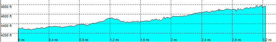
| length | 3.3 mile - 1 hour 30 minutes (one way). Moderate. |
| Height | 4290 - 4770 feet |
| Access | All Cars, all paved. Jack's Canyon road, take a short dirth road, marked trail, to the right. | Other Trails | Start at the same place: Rabit Ears trail and Hot Loop trail |
| Data | To download these files, right-click the link and choose 'save as' |--| .GPX (GPS file) |-----| ,KML (GoogleEarth file) |