|
| Borrego Springs: Wilson trail |
| Rating | ***** |
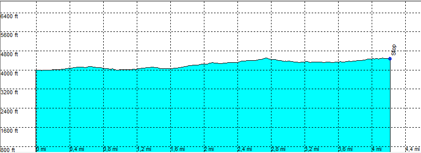
| length | 8.5 mile - 3 hour 40 minutes (Round trip). Easy. |
| Height | 3990 - 4490 feet |
| Access | Start at S22 Mile 10.5 On Old Culp Valley Road. Check the road conditions at the visitor center. A high clearance car is essential and an AWD is preferred and sometimes necessary. |
| Other Trails | |
| Data | To download these files, right-click the link and choose 'save as' |--| .GPX (GPS file) |-----| .KML (Google Earth file) |