|
| Borrego Springs: Whale Peak South |
| Rating | ***** |
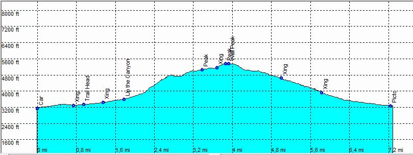
| length | 7.7 mile - 3 hour (up) 2 hour 30 minutes (down). Moderate/Hard. |
| Height | 3130 - 5350 feet |
| Access | On the S2 mile 22-23. Butterfield Stage Route, Blair Valley. Take this well maintained dirt road, most of the time for all cars. |
| Other Trails | |
| Data | To download these files, right-click the link and choose 'save as' |--| .GPX (GPS file) |-----| .KML (Google Earth file) |