|
| Borrego Springs: Palm Canyon Trail |
| Rating | ***** |
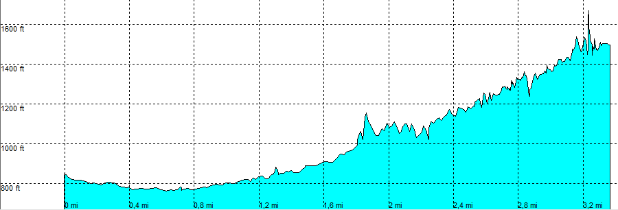
| length | 3.3 mile - 2 hour 10 minutes (one way). Moderate / (beyond the palm oasis) Hard . |
| Height | 840 - 770 - 1500 feet |
| Access | All Cars, all paved. At the Visitor Centre in the large parking area, or at the campground (closer) in the large parking area. |
| Other Trails | None |
| Data | To download these files, right-click the link and choose 'save as' |--| .GPX (GPS file) |-----| .KML (Google Earth file) |