|
| Borrego Springs: 1-5-17 Palm trail |
| Rating | ***** |
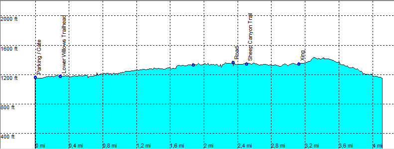
| length | 4.1 mile - 2 hour (round trip) add 1 hour if you can't make it to the gate. Easy. |
| Height | 1130 - 1420 feet |
| Access | Take the dirt road into Coyote canyon. You may make it to 1e crossing in a regular car, after that a high clearance or AWD is needed. (check road conditions at the visitors center). |
| Other Trails | California Riding and Hiking Trail |
| Data | To download these files, right-click the link and choose 'save as' |--| .GPX (GPS file) |-----| .KML (Google Earth file) |