|
| Borrego Springs: Calcite Mine - Palm Wash |
| Rating | ***** |
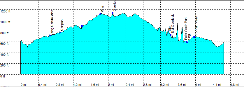
| length | 6.1 mile - 3 hour (round trip). Easy/Moderate. |
| Height | 540 - 1100 feet |
| Access | At Hwy S-22 Borrego Springs <-> Salton Sea Mile 38. Accessible by all cars. |
| Other Trails | |
| Data | To download these files, right-click the link and choose 'save as' |--| .GPX (GPS file) |-----| .KML (Google Earth file) |