|
| Borrego Springs: Box Canyon |
| Rating | ***** |
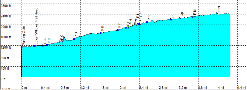
| length | 9.4 mile - 2 hour 15 minutes (up) and 2 hour (down). Moderate. |
| Height | 1140 - 2400 feet |
| Access | Take the dirt road into Coyote Canyon and park at the gate just before 3th Crossing. Normally you need at least a high clearance car, from first Crossing (check at the visitor center at Borrego Springs). |
| Other Trails | C |
| Data | To download these files, right-click the link and choose 'save as' |--| .GPX (GPS file) |-----| .KML (Google Earth file) |