|
| Borrego Springs: Box Canyon Trail |
| Rating | ***** |
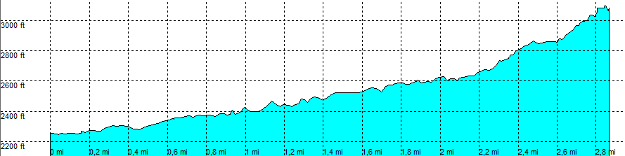
| length | 5.8 mile - 3 hour 30 minutes (round trip). Moderate. |
| Height | 2250 - 3090 feet |
| Access | All Cars, all paved. On route S2, south of marker 27, park in a parking area. |
| Other Trails | None |
| Data | To download these files, right-click the link and choose 'save as' |--| .GPX (GPS file) |-----| .KML (Google Earth file) |