|
| Sedona - Wilson Mountain South Trail |
| Rating | ***** |
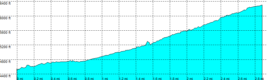
| length | 2.8 mile - 1 hour 30 minutes (one way). Moderate. |
| Height | 4520 - 6300 feet |
| Access | All Cars, all paved. Highway 89A Direction Flagstaff, at the bridge. At the parking lot (left) (may be busy, you want to come early). |
| Other Trails | You reach the Wilson Mountain North Trail at First Bench. Connects to: Jim Thomson - Wilson Canyon Trail |
| Data | To download these files, right-click the link and choose 'save as' |--| GPX (GPS file) |-----| KML (Google Earth file) |