|
| Sedona - Submarine Rock Trail |
| Rating | ***** |
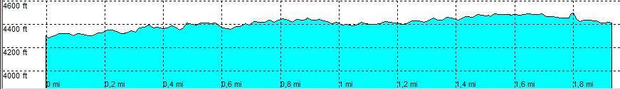
| length | 3.2 mile - 1 hour 15 minutes (round trip). Moderate. |
| Height | 4290 - 4480 feet |
| Access | All Cars, all paved. Parking at the end of Morgan Road in the Parking Lot. |
| Other Trails | Connects to: Margs Draw trail and Broken Arrow loop trail |
| Data | To download these files, right-click the link and choose 'save as' |--| .GPX (GPS file) |-----| .KML (Google Earth file) |