|
| Sedona - Margs Draw Trail |
| Rating | ***** |
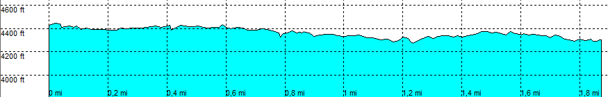
| length | 1.9 mile - 1 hour (one way). Easy. |
| Height | 4430 - 4270 feet |
| Access | All Cars, all paved. End of the pavement of Schnelbly Hill Road, left at the parking lot. |
| Other Trails | Connects to: Submarine Rock trail and Broken arrow loop trail. Starting at the same place: Huckaby trail and Munds Wagon trail |
| Data | To download these files, right-click the link and choose 'save as' |--| GPX (GPS file) |-----| KML (Google Earth file) |