|
| Sedona - Llama Loop Trail |
| Rating | ***** |
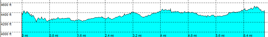
| length | 6.9 mile - 3 hour 15 minutes (round trip). Easy. |
| Height | 4370 - 4500 feet |
| Access | All Cars, all paved. Chappel Road (at point 1) (left) or at the Chappel (end of the road) at the parking lot (busy). |
| Other Trails | Connects to: Courthouse Butte trail and Broken arrow loop trail |
| Data | To download these files, right-click the link and choose 'save as' |--| GPX (GPS file) |-----| KML (Google Earth file) |