|
| Prescott - Granite Mountain Trail |
| Rating | ***** |
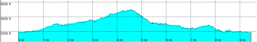
| length | 9.5 mile - 3 hour 50 minutes (round trip). Moderate. |
| Height | 5180 - 5790 feet |
| Access | All Cars, all paved. On Simons Highway / Wiliams Valley Road northwest of Prescott. Park on the parking area on the left |
| Other Trails | Nearby trail little Granite Mountain trail |
| Data | To download these files, right-click the link and choose 'save as' |--| .GPX (GPS file) |-----| .KML (Google Earth file) |