Palm Springs picture
Palm Springs: Palm Canyon

Rating *****
length 6.5 mile - 2 hour 55 minutes (round trip). Moderate.
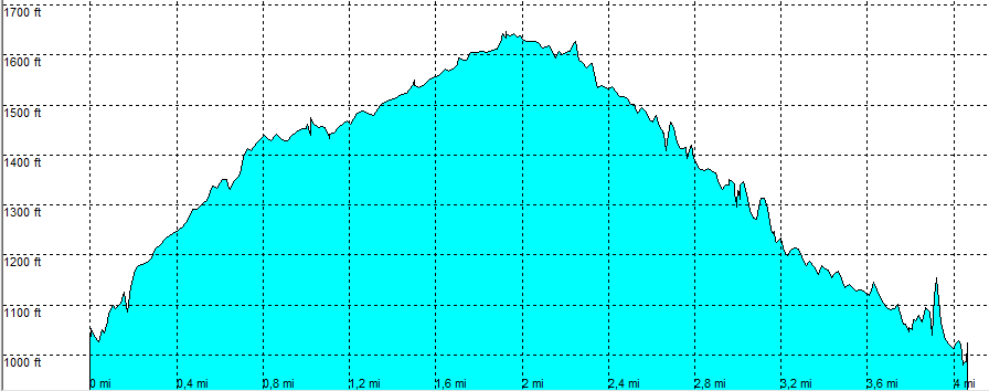
Height 860 - 1640 feet
Access All Cars, all paved. Take South Palm Canyon Drive (south), at the end the road narrows, untill you get at the toll gate (rates). Follow the road to the trading post, park at the parking area
Other Trails A lot of trails start here
Data To download these files, right-click the link and choose 'save as' |--| .GPX (GPS file) |-----| .KML (Google Earth file)

  • Back

  • Expect only shade in the first and last part of the hike. First part in a Palm forest, next up a rocky trail, following a sandy wash and down a narrow rocky canyon.

    At the trading post in indian canyons head down on the stairs (south). At crossing [3] follow Palm Canyon Trail uphill out of the canyon.
    At crossing [4] take the Dry Wash Trail left (east). Head north at the next crossing [6] with East Fork Trail.
    At crossing [7] stay on East Fork Trail heading down in a canyon on a more difficult trail with some (dry in October) waterfalls.


    Palm Canyon Trail
    Disclamer: Read this first before you start your hike.
    Contact: usa/at/e/f/m/e/r/.eu (leave out the /)
    All hikes recorded on pocket loox (pocket PC) using gpsTuner(.com)
    Hiking Palm Canyon Trail Palm Springs Area California, Hike with gps, gpx and kml (Google Earth).