|
| Joshua Tree - Fourtynine Palms Oasis Trail |
| Rating | ***** |
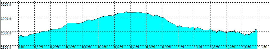
| length | 1.5 mile - 0 hour 50 minutes (one way). Moderate. |
| Height | 2730 - 3070 - 2750 feet |
| Access | All Cars, all paved. On Twentynine Palms Highway, turn on Fourtynine Palms Canyon Rd, park in the parking area at the end of the road |
| Other Trails | None |
| Data | To download these files, right-click the link and choose 'save as' |--| .GPX (GPS file) |-----| .KML (Google Earth file) |