|
| Borrego Springs: Palm Springs Loop |
| Rating | ***** |
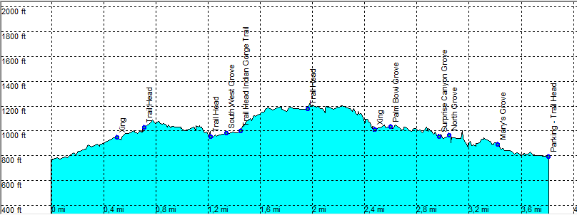
| length | 4 mile - 2 hour 40 minutes (Round trip). Easy. |
| Height | 770 - 1970 feet |
| Access | Highway S2 Mile 47 exit Campground. On a good dirt road (all cars) along the campground to the trail head. |
| Other Trails | |
| Data | To download these files, right-click the link and choose 'save as' |--| .GPX (GPS file) |-----| .KML (Google Earth file) |