Borrego Springs picture
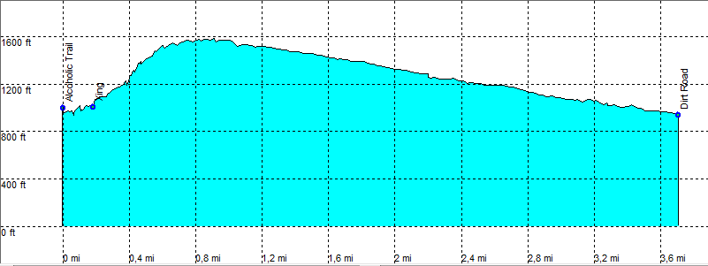
Borrego Springs: Alcoholic trail

Rating *****
length 7.6 mile - 3 hour 30 minutes (round trip). Easy/Moderate.
Height 240 - 1830 feet
Access Sometimes all cars, but mostly high clearence. Check at the visitor centre.
Other Trails
Data To download these files, right-click the link and choose 'save as' |--| .GPX (GPS file) |-----| .KML (Google Earth file)

  • Back

  • Starts on the Coyote Canyon road.
    The first part goes directly up mountain to the pass.
    Through the pass the trail goes into an ever widening sandy wash.
    This part is harder than it looks because of the loose sand.
    Most of the flowers, we found close to the end (March). The trail ends at Rockhouse canyon rd (dirt road).


    Efmer_Borrego_alcoholic_trail
    Disclamer: Read this first before you start your hike.
    Contact: usa/at/e/f/m/e/r/.eu (leave out the /)
    All hikes recorded on pocket loox (pocket PC) using gpsTuner(.com)
    Hiking Hellhole Canyon Trail Borrego Springs Area (Anza-Borrego Desert State Park) California, Hike with gps, gpx and kml (Google Earth).