|
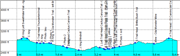
| Tucson - Thunderbird - Gia Monster - Coyote Pass - Brittle Bush Loop |
| Rating | ***** |
| length | 6.7 mile - 3 hour 15 minutes (round trip). Moderate. |
| Height | 2430 - 2900 feet |
| Access | All Cars, Access from El Camino del Cerro. There is a parking at the trail head. |
| Other Trails | |
| Data | To download these files, right-click the link and choose 'save as' |--| GPX (GPS file) |-----| KML (Google Earth file) |