|
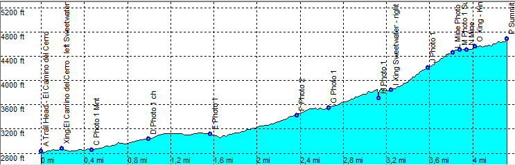
| Tucson - Sweetwater - King Canyon - Wasson Peak |
| Rating | ***** |
| length | 8.8 mile - 4 hour 30 minutes (round trip). Moderate. |
| Height | 2790 - 4670 feet |
| Access | All Cars, Start at the El Camino del Cerro. There is a parking at the trail head. Busy in weekends, mostly empty on weekdays.. |
| Other Trails | |
| Data | To download these files, right-click the link and choose 'save as' |--| GPX (GPS file) |-----| KML (Google Earth file) |