|
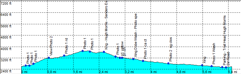
| Tucson - Hugh Morris Esperanza Dobe Bajada Loop |
| Rating | ***** |
| length | 6.6 mile - 3 hour 15 minutes (round trip). Moderate/Easy. |
| Height | 2520 - 3670 feet |
| Access | All Cars, Park at the Hugh Norris Trail Head. |
| Other Trails | |
| Data | To download these files, right-click the link and choose 'save as' |--| GPX (GPS file) |-----| KML (Google Earth file) |