|
| Tucson - David Yetman Golden Gate Ironwood Loop |
| Rating | ***** |
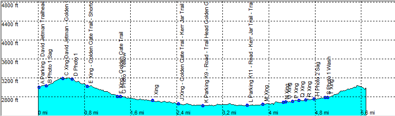
| length | 5.8 mile - 2 hour 40 minutes (round trip). Easy. |
| Height | 2600 - 3180 feet |
| Access | All Cars, From Tucson take Gates Pass Road. Over the pass take the first parking to the left (G3 Viewpoint). |
| Other Trails | |
| Data | To download these files, right-click the link and choose 'save as' |--| GPX (GPS file) |-----| KML (Google Earth file) |