|
| Tucson - Cam Boh - Panther - Roadrunner Loop |
| Rating | ***** |
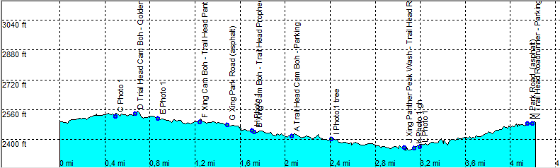
| length | 4.3 mile - 2 hour (round trip). Easy. |
| Height | 2340 - 2540 feet |
| Access | All Cars, Take the Picture Rocks Road, just as you exit the park (from Tucson), the Cam Boh Parking is on the left. |
| Other Trails | |
| Data | To download these files, right-click the link and choose 'save as' |--| GPX (GPS file) |-----| KML (Google Earth file) |