Sedona picture
Tucson - Pontatoc Ridge Trail

Rating *****
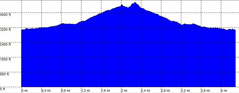
length 4.5 mile - 3 hour 20 minutes (round trip). Easy/Moderate.
Height 3070 - 4520 feet
Access All Cars
Other Trails
Data To download these files, right-click the link and choose 'save as' |--| GPX (GPS file) |-----| KML (Google Earth file)

  • Back

  • A Nice Hike along the Pontatoc Ridge.

    Shortly after the trailhead the Pontatoc (ridge) trial goes straight on, as the finger trail turns left.

    Uphill on Xing 1 the ridge trail turns right.
    Turning around the hill and up the ridge. Some slick rock will make the trail a bit more difficult to find, but overall the trail is easy to follow.

    At Xing2 the official trail keeps left and ends at a sign.
    At Xing2 turning uphill on a slippery (steep/gravel) trail to the "Summit".
    This part is way more difficult coming down, have your hiking sticks along.

    Hiking time: Subtract at least 30 Minutes for the "Summit".


    Pontatoc Ridge Trail

    Disclamer: Read this first before you start your hike.
    Contact: usa/at/e/f/m/e/r/.eu (leave out the /)
    All hikes recorded on pocket loox (pocket PC) using gpsTuner(.com)
    Hiking Tucson - Pontatoc Ridge Trail Arizona, Hike with gps, gpx and kml (Google Earth).