|
| Tucson - Picacho Peak |
| Rating | ***** |
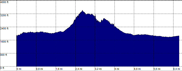
| length | 7.4 mile - 4 hour 20 minutes (round trip). Moderate/more difficult. |
| Height | 1780 - 3400 feet |
| Access | All Cars, Picacho Peak State Park, Free +$7 / car. WARNING: the park may be closed. |
| Other Trails | |
| Data | To download these files, right-click the link and choose 'save as' |--| GPX (GPS file) |-----| KML (Google Earth file) |