|
| Tucson - Loma Alta |
| Rating | ***** |
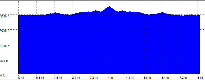
| length | 8.2 mile - 3 hour 30 minutes (round trip). Easy. |
| Height | 3150 - 3600 feet |
| Access | All Cars, no fee at trailhead |
| Other Trails | |
| Data | To download these files, right-click the link and choose 'save as' |--| GPX (GPS file) |-----| KML (Google Earth file) |