|
| Tucson - La Milagrosa Loop |
| Rating | ***** |
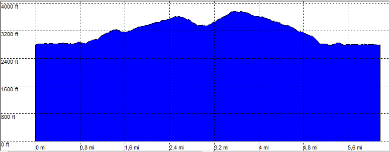
| length | 6.3 mile - 3 hour 30 minutes (round trip). Moderate. |
| Height | 2750 - 3750 feet |
| Access | All Cars, parking along the road, just before the gate. |
| Other Trails | |
| Data | To download these files, right-click the link and choose 'save as' |--| GPX (GPS file) |-----| KML (Google Earth file) |