|
| Tucson - Bug Spring Trail |
| Rating | ***** |
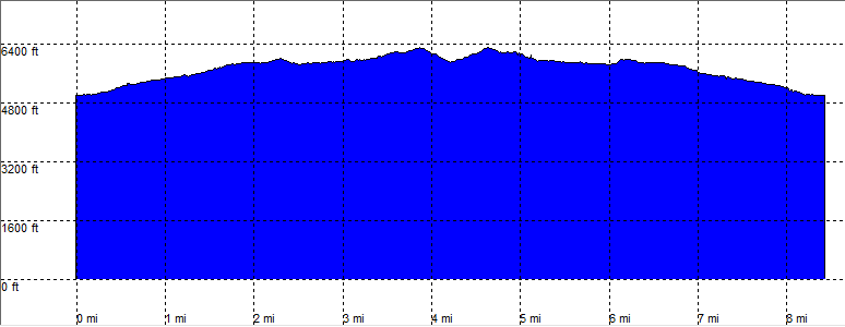
| length | 8.6 mile - 4 hour (round trip). Moderate. |
| Height | 4990 - 6280 feet |
| Access | All Cars, at the clearly marked parking lot. |
| Other Trails | |
| Data | To download these files, right-click the link and choose 'save as' |--| GPX (GPS file) |-----| KML (Google Earth file) |