|
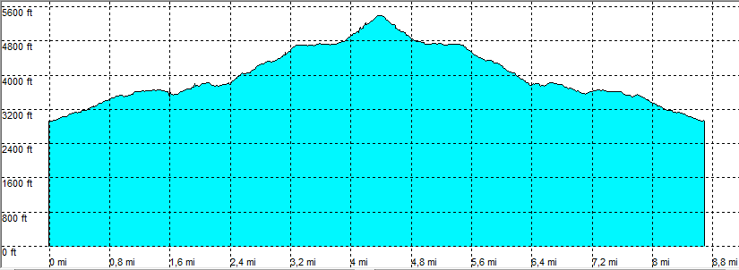
| Tucson - Aqua Caliente Hill |
| Rating | ***** |
| length | 9 mile - 4 hour 45 minutes (round trip). Moderate. |
| Height | 2930 - 5370 feet |
| Access | All Cars, there is parking at the trailhead. |
| Other Trails | |
| Data | To download these files, right-click the link and choose 'save as' |--| GPX (GPS file) |-----| KML (Google Earth file) |