|
| Sedona - Vultee Arch |
| Rating | ***** |
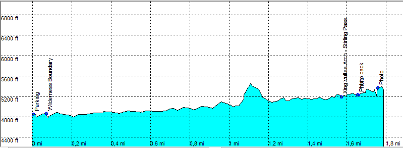
| length | 3.9 mile - 1 hours 50 minutes (round trip). Easy. |
| Height | 4780 - 5350 feet |
| Access | From Sedona take the Dry Creek Road, exit right on FR152. A high clearance car is preferred on this rocky bumpy road but there are always regular cars making it along this road. |
| Other Trails | |
| Data | To download these files, right-click the link and choose 'save as' |--| GPX (GPS file) |-----| KML (Google Earth file) |