|
| Sedona - Turkey Creek Crater Trail |
| Rating | ***** |
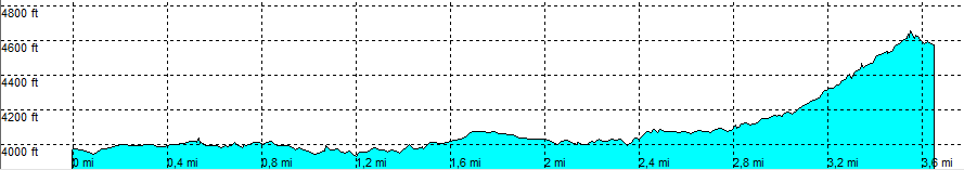
| length | 3.7 mile - 2 hour 5 minutes (one way). Moderate. |
| Height | 3960 - 4620 feet |
| Access | All Cars, all paved (point 1), high clearance car (point 2). Take Red Rock Crossing Road and turn left. Park into a parking lot. |
| Other Trails | None |
| Data | To download these files, right-click the link and choose 'save as' |--| .GPX (GPS file) |-----| .KML (Google Earth file) |