|
| Sedona - Telephone Trail |
| Rating | ***** |
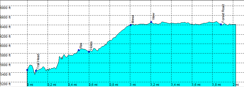
| length | 3.5 mile (return) - 1 hour up, 45 minutes down, 30 minutes on the mesa. Hard. |
| Height | 5400 - 6400 feet |
| Access | All Cars, Take Hwy 89A North, direction Flagstaff. Park just after West Fork on the right hand side (Mile 385.1) at a small parking, along the road under a high cliff. |
| Other Trails | |
| Data | To download these files, right-click the link and choose 'save as' |--| GPX (GPS file) |-----| KML (Google Earth file) |