|
| Sedona - Strirling Vultee Trail |
| Rating | ***** |
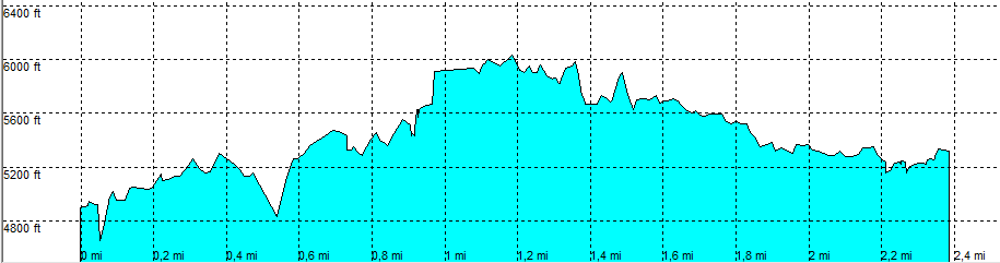
| length | 2.4 mile - 1 hour 50 minutes (one way). Hard. |
| Height | 4890 - 6000 - 5240 feet |
| Access | All Cars, all paved. Highway 89A in the direction of Flagstaff at MP 380.4 left. Park Anywhere |
| Other Trails | None |
| Data | To download these files, right-click the link and choose 'save as' |--| GPX (GPS file) |-----| KML (Google Earth file) |