|
| Sedona - Soldier Pass - Brins Mesa Trail |
| Rating | ***** |
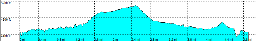
| length | 5 mile - 2 hour 15 minutes (round trip). Moderate. |
| Height | 4400 - 5100 feet |
| Access | All Cars, all paved. At the end of East Park Ridge Drive, park at the parking lot. |
| Other Trails | Connects to: Teacup trail and Jim Thomson - Wilson Canyon |
| Data | To download these files, right-click the link and choose 'save as' |--| .GPX (GPS file) |-----| .KML (Google Earth file) |