|
| Sedona - Soldier Pass Arch |
| Rating | ***** |
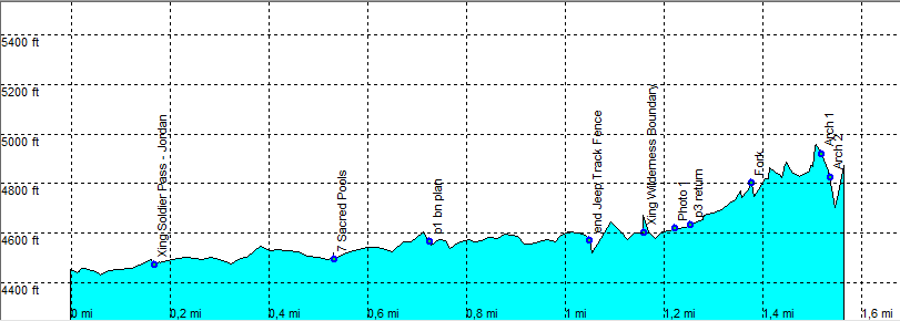
| length | 3.5 mile - 1 hour 45 minutes (round trip). Easy. |
| Height | 4430 - 4900 feet |
| Access | All Cars, Take the Soldier Pass Road (North) in Sedona to the parking of the Soldier Pass. |
| Other Trails | |
| Data | To download these files, right-click the link and choose 'save as' |--| GPX (GPS file) |-----| KML (Google Earth file) |