|
| Sedona - Schuerman Trail |
| Rating | ***** |
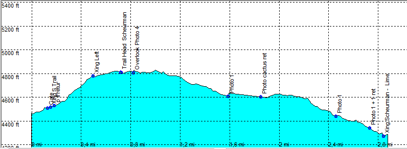
| length | 5.1 mile - 2 hours 25 minutes (round trip). Easy. |
| Height | 4280 - 4810 feet |
| Access | All Cars, From Sedona take Hyw 89A direction Cottonwood. Turn left on Upper Red Rock Loop Road. Turn right just after the high school (0.3 Mile), on a road marked staff parking only. The trail parking is almost directly to the left on a dirt parking lot. |
| Other Trails | |
| Data | To download these files, right-click the link and choose 'save as' |--| GPX (GPS file) |-----| KML (Google Earth file) |