|
| Sedona - Red Rocks Loop Trail |
| Rating | ***** |
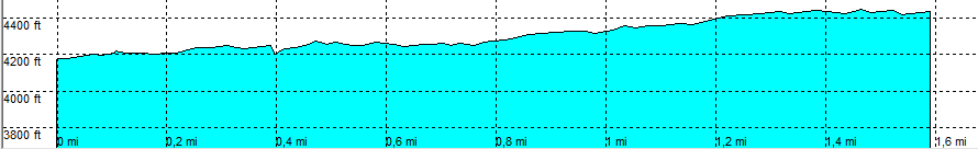
| length | 1.6 mile - 30 minutes (one way). Easy. |
| Height | 4170 - 4420 feet |
| Access | All Cars, all paved (point 1). High Clearance (point 2) Take Red Rock Loop Road (direction Red Rock State Park) |
| Other Trails | None |
| Data | To download these files, right-click the link and choose 'save as' |--| .GPX (GPS file) |-----| .KML (Google Earth file) |