|
| Sedona - Loy Canyon Trail |
| Rating | ***** |
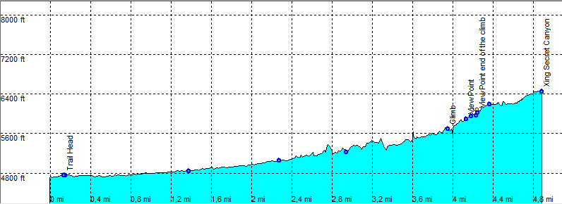
| length | 11 mile - 4 hour 30 minutes (round trip). Moderate. |
| Height | 4700 - 6410 feet |
| Access | All Cars, Take Forest road (dirt) 525 Loy Canyon. |
| Other Trails | |
| Data | To download these files, right-click the link and choose 'save as' |--| GPX (GPS file) |-----| KML (Google Earth file) |