|
| Sedona - Lost Canyon Trail |
| Rating | ***** |
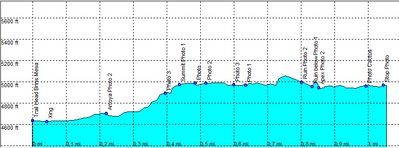
| length | 2.2 mile - 1 hours 45 minutes (round trip). Moderate. |
| Height | 4630 - 4980 feet |
| Access | Take Dry Creek road from Sedona. Dry Creek road turns right (FR 152) and becomes an unpaved road (Direction Brins Mesa / Vultee Arch). Suitable for high clearance cars, but the occasional regular car makes it to the trail head. |
| Other Trails | |
| Data | To download these files, right-click the link and choose 'save as' |--| GPX (GPS file) |-----| KML (Google Earth file) |