|
| Sedona - Huckaby Casner Damifno Munds Loop |
| Rating | ***** |
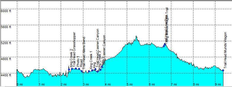
| length | 9.8 mile - 4 hours 30 minutes (round trip). Moderate/Hard. |
| Height | 4270 - 5240 feet |
| Access | All Cars, see below. |
| Other Trails | |
| Data | To download these files, right-click the link and choose 'save as' |--| GPX (GPS file) |-----| KML (Google Earth file) |