Sedona picture
Sedona - Dry Creek Trail

Rating *****
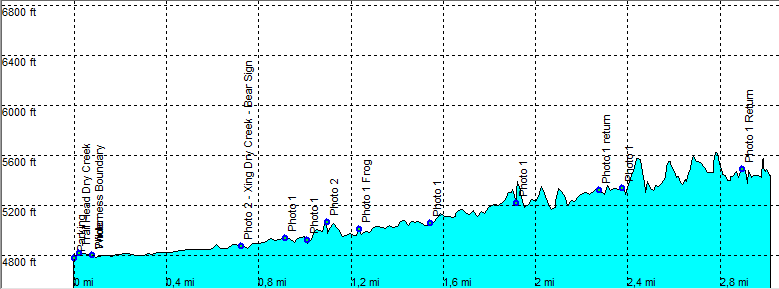
length 7.1 mile - 3 hours (round trip). Moderate.
Height 4800 - 5400 feet
Access From Sedona take the Dry Creek Road, exit right on FR152. A high clearance car is preferred on this rocky bumpy road but there are always regular cars making it along this road.
Other Trails
Data To download these files, right-click the link and choose 'save as' |--| GPX (GPS file) |-----| KML (Google Earth file)

  • Back

  • Nice canyon hike, in a more open canyon up to a fork.
    The trail head is at the end of the road at the left.

    This trail takes you along Dry Creek crossing it several times.
    Sometimes the trail is harder to find and runs in the stream bed.
    Closer to the end the trail gets less hiked and is fainter and more difficult to find. Look for cairns along the trial.
    The trail ends at a fork.
    The Dry Creek as the name suggests, is mostly dry as it was in April 2009.
    There is shade, mostly as you head further into the canyon.
    Nice red rocks, although sometimes hard to see because of the trees.


    09_Efmer_Sedona_dry_creek
    Disclamer: Read this first before you start your hike.
    Contact: usa/at/e/f/m/e/r/.eu (leave out the /)
    All hikes recorded on pocket loox (pocket PC) using gpsTuner(.com)
    Hiking Dry Creek Trail Sedona Arizona, Hike with gps, gpx and kml (Google Earth).