|
| Sedona - Damifino Casner Canyon Munds Loop |
| Rating | ***** |
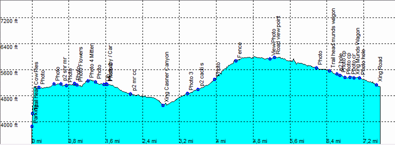
| length | 8 mile - 4 hours 15 minutes (round trip). Moderate, need some experience. |
| Height | 4490 - 5990 feet |
| Access | Take Schnebly Hill road up to the cow pie trail head. The last part of this road is rough and rocky and is normally for high clearance cars only. (but we saw some regular cars make it all the way.) |
| Other Trails | |
| Data | To download these files, right-click the link and choose 'save as' |--| GPX (GPS file) |-----| KML (Google Earth file) |