|
| Sedona - Brins Mesa Trail |
| Rating | ***** |
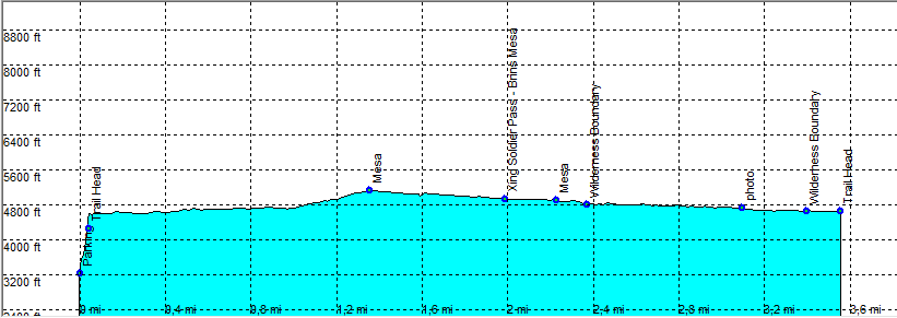
| length | 7.4 mile - 3 hours (round trip). Moderate/Easy. |
| Height | 4500 - 5100 feet |
| Access | All Cars, In uptown Sedona (direction Flagstaff) take Jordan Road and at the end go left following the trailhead signs. |
| Other Trails | |
| Data | To download these files, right-click the link and choose 'save as' |--| GPX (GPS file) |-----| KML (Google Earth file) |