|
| Sedona - Beaverhead Route |
| Rating | ***** |
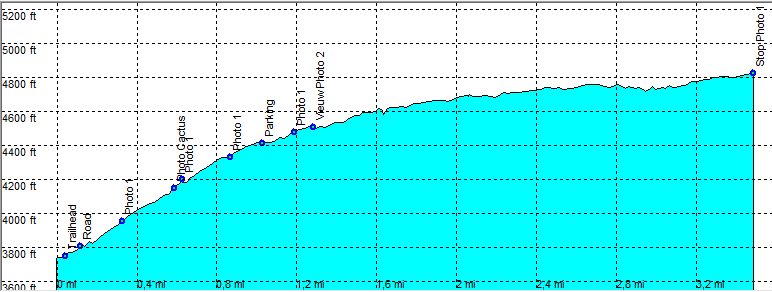
| length | 7 mile - 3 hour 15 minutes (round trip). Moderate/Easy. |
| Height | 3720 - 4800 feet |
| Access | All Cars, Take Hwy 179 to Phoenix. After the village of Oak Creek at Mile 303, the second dirt road on you left. If you see cairns just beyond the gate you're on the right one. Park the car just outside the gate, it is probably no longer allowed to drive any further.. |
| Other Trails | |
| Data | To download these files, right-click the link and choose 'save as' |--| GPX (GPS file) |-----| KML (Google Earth file) |