|
| Sedona - Bear sign trail |
| Rating | ***** |
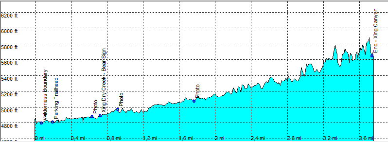
| length | 8.9 mile - 3 hours 20 minutes (round trip). Easy. |
| Height | 4820 - 5700 feet |
| Access | The road is for high clearance cars, but some regular cars made it all the way. From Sedona on Dry Creek Road Take F152, the Vultee Arch Road on the right. Drive this rocky and bumpy road to the end and park. |
| Other Trails | |
| Data | To download these files, right-click the link and choose 'save as' |--| GPX (GPS file) |-----| KML (Google Earth file) |