|
| Sedona - AB Young Trail |
| Rating | ***** |
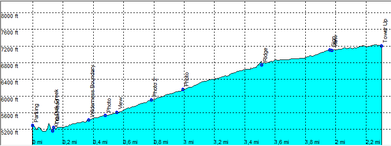
| length | 5.3 mile - 1 hours 40 minutes up, 1 hour 30 minutes down. Moderate/Hard. |
| Height | 5200 - 7200 feet |
| Access | All Cars, Take Hwy 89A (Mile 383) to Bootlegger campground, park just past the campground on the right. (you are not allowed to park on the campground). |
| Other Trails | |
| Data | To download these files, right-click the link and choose 'save as' |--| GPX (GPS file) |-----| KML (Google Earth file) |