Sedona picture
Sedona - Hot loop lower Trail

Rating *****
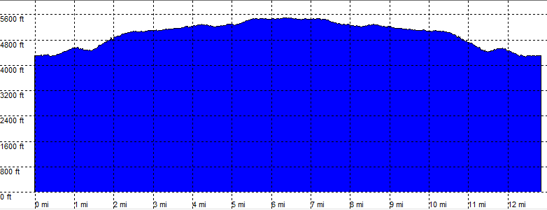
length 13.1 mile - 5 hours 35 minutes (return). Moderate.
Height 4290 - 5470 feet
Access All Cars.
Other Trails
Data To download these files, right-click the link and choose 'save as' |--| GPX (GPS file) |-----| KML (Google Earth file)

  • Back

  • First part of the Hot Loop Trail.

    Take the short dirt road opposite the canyon ridge cir on the Jacks Canyon Road.
    The dirt parking should be passable for all cars.

    The trail leads up to the saddle and down again, until reaching the other Hot loop trail from Woods Canyon.
    Turn left on the old unmarked wagon trail.
    This is a rocky and probably the most difficult part of the hike.

    The Xing 2 leads to an overview on the left.

    The rest of the trail up to stop is relatively level. The tail is parts sand and parts rocky.

    After about 3 hours the stop point close to the canyon wall of Woods Canyon with excellent views in all directions.
    This is the "halfway" point, the rest of the trail can be hiked from the other side.


    Hot loop lower trail

    Disclamer: Read this first before you start your hike.
    Contact: usa/at/e/f/m/e/r/.eu (leave out the /)
    All hikes recorded on pocket loox (pocket PC) using gpsTuner(.com)
    Hiking Hot loop lower Trail Sedona Arizona, Hike with gps, gpx and kml (Google Earth).